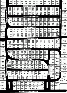
Maps - Kimberley North Subdivision
For maps showing lot numbers and subdivision sections see: More maps of Kimberley North -
Interactive Google Map of Kimberley North:
Print Directories
A hard-copy version of the Kimberley North resident directory is published about once every year or two. These are mailed out to all KNIA homes when new versions are available. These directories include names, addresses, and phone number of residents (by name and by street) unless they opt out.
The Township website also has a variety of WB Township maps useful for a variety of purposes.
Included there you'll find the following maps: Census 2010 - Total Person Count per Block, Census 2010 - Total Vacant to Occupied, Drains Map, Environmental Features, Existing Land Use, Future Land Use, GFL-USA Waste Hauler Schedule, Mineral Lease Nominations, Non Motorized Safety Path, Pavement Conditions, Precincts Map, Road Construction Projects, Road Map, School Districts and Community Facilities, School Districts and Zip Codes, Soils Map, Subdivision Map, Water Course Map, Watershed Boundary Map, Wetlands Map - Full Township, Woodlands Map, Zip Code Map, Zoning Map


